Click on each tab to open for more information. Click tab again to close.
SMA utilizes data modeling software that allows us to present complex geological, hydrogeological, and chemical data in two- and three-dimensions (2D/3D), with an option to also show temporal data through time-lapse animations.
3D models depicting the results of three subsurface soil investigations. The investigations were performed by SMA in order to determine the amount of soil contamination from spills of three different chemicals, including, a degreasing solvent (trichloroethylene), chromic acid plating solution (chromium), and a cleaning solvent (toluene). All of the models were constructed using actual field collected data.
3D models depicting the results of three subsurface soil investigations involving spills of perchloroethylene (PCE). The investigations were performed at a dry cleaner, former ink manufacturing facility, and a chemical storage facility. The models helped reduce the costs of the remediation by identifying the sources of the spills and targeting the worst areas of contamination.
The animation above presents several 3D models depicting four different technologies used by SMA to successfully remediate soil contamination. The technologies include, electrical resistance heating (ERH), soil vapor extraction (SVE), in-situ chemical oxidation, and excavation of contaminated soils. All of the models were constructed using actual field collected data.
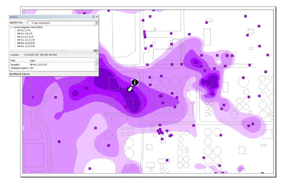
A geographic information system (GIS) is a powerful set of tools that allows the collection and analysis of all manner of geospatial data and gives the user sophisticated ways to relate and view that information on a map. The way data is viewed can have a powerful impact on understanding and creating efficient solutions to complex problems. At SMA, we use the latest industry-standard ESRI ArcGIS™ software and related data processing and visualized tools to give our clients traditional to cutting-edge mapping options that allow them to choose how best to present and view their data. The software utilized by SMA includes:
Seamlessly integrating data and visualizations from our other data management and visualization services utilizing software such as AutoCad, EQuIS (Earthsoft, Inc. data base), and EVS (2D and 3D Data Modeling), we can optimize our cross-platform capabilities and maximize efficiency and accuracy.
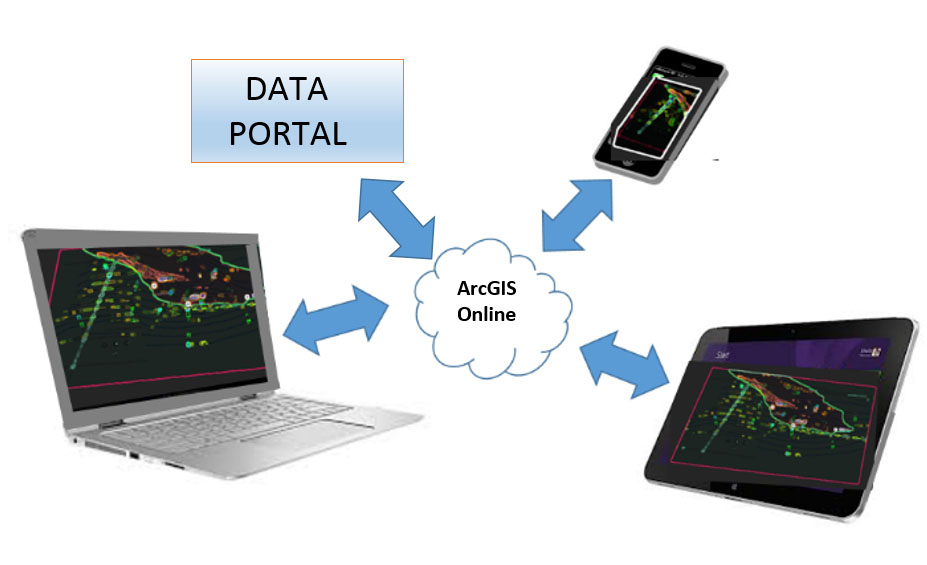
SMA also uses the latest innovations to keep pace in an industry that is constantly changing and with our Interactive and Web mapping options, we can create maps that can be accessed by any mobile device, giving our clients access to their data wherever and whenever they need it.
SMA offers a variety of Geospatial Services including:
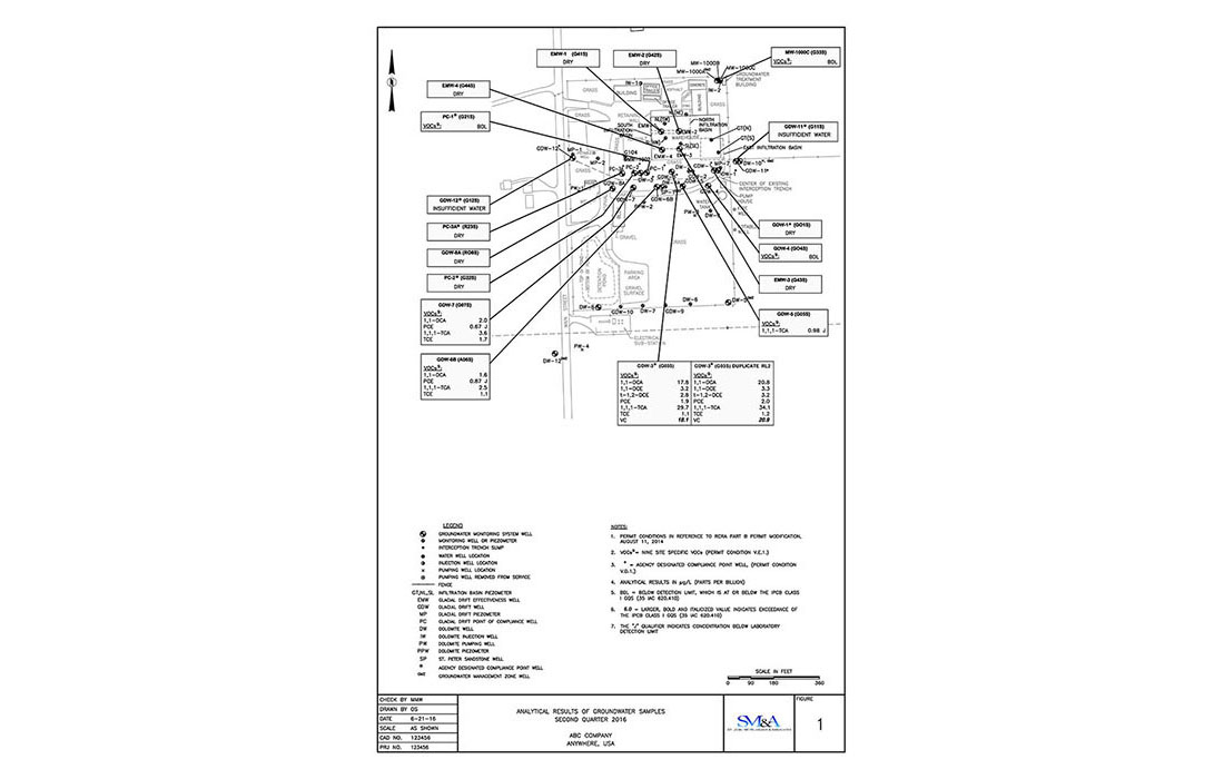
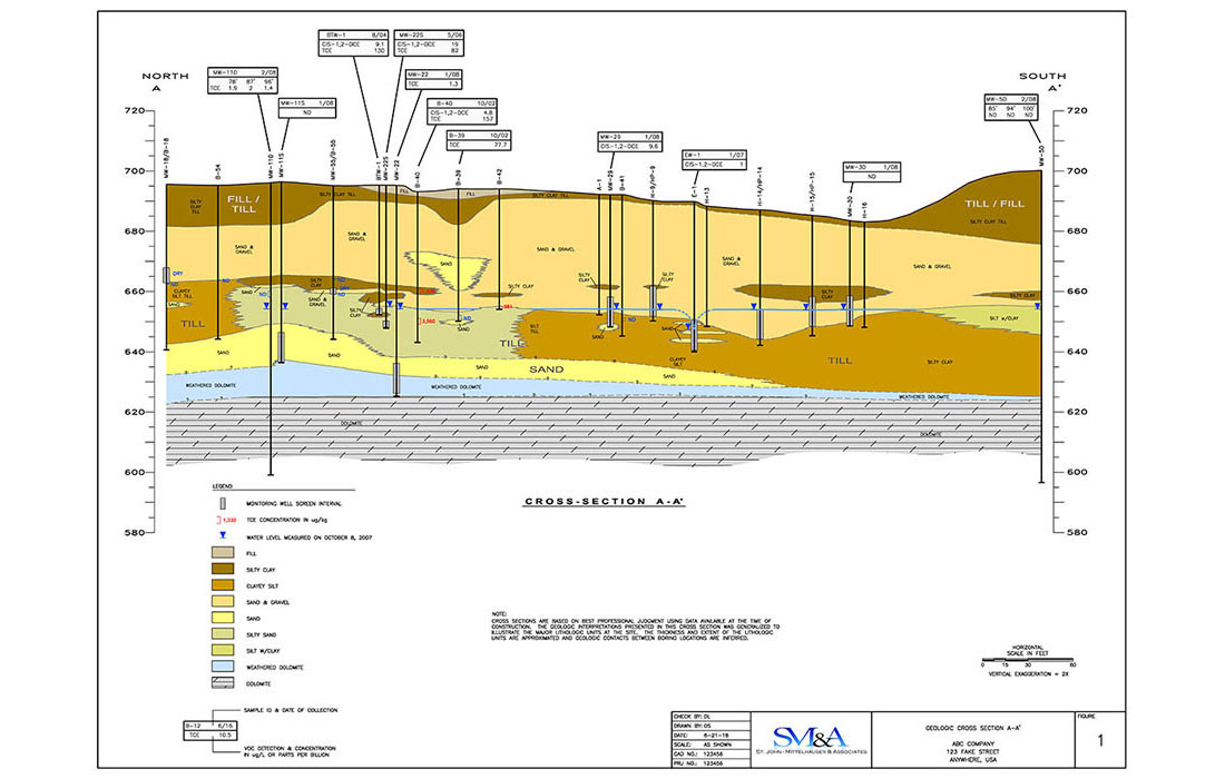
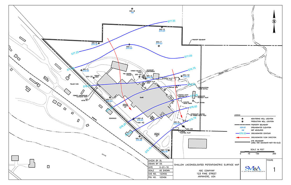
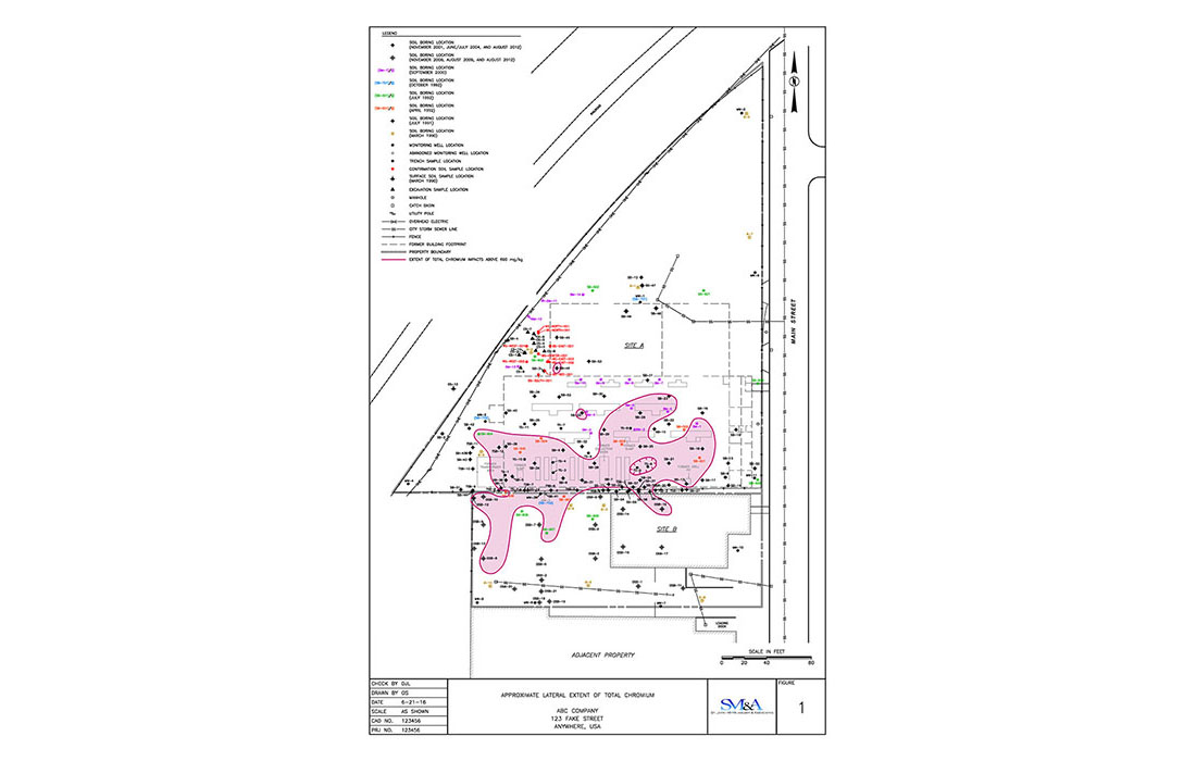
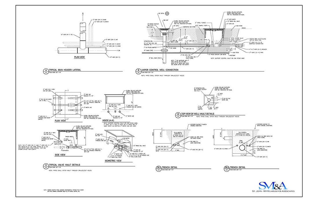
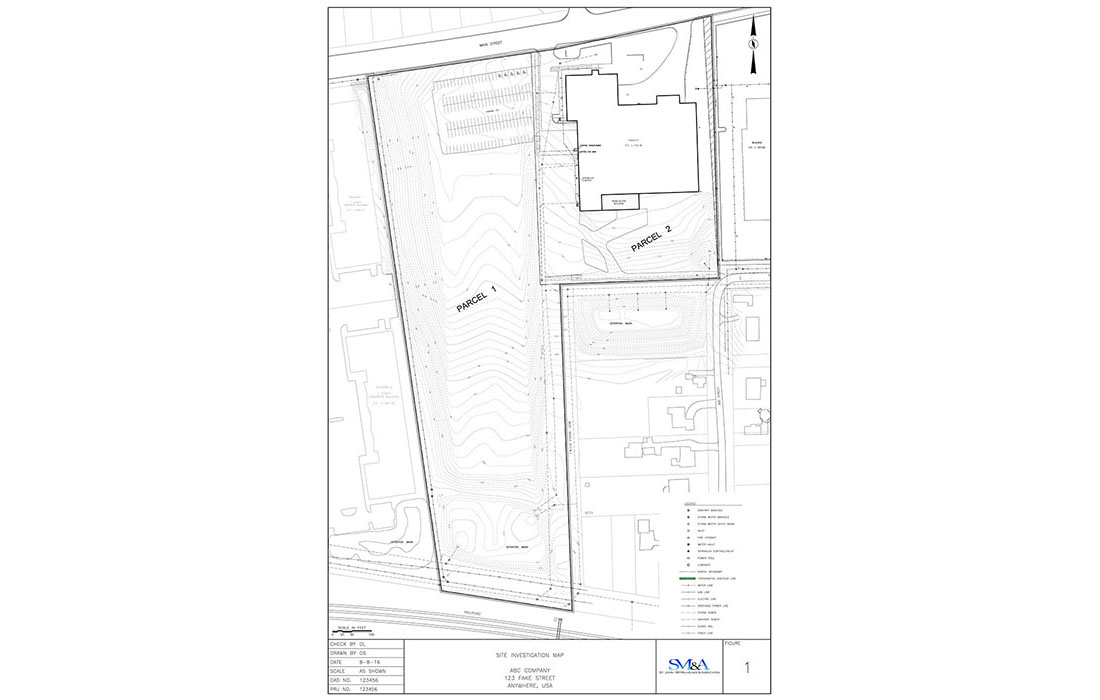
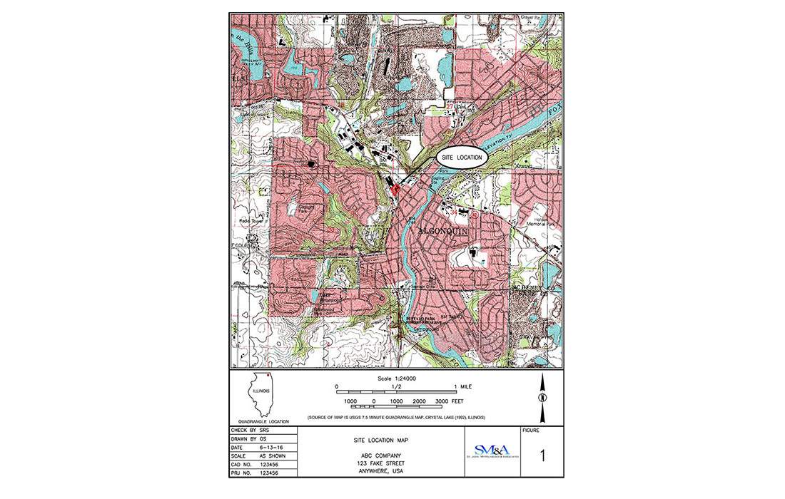
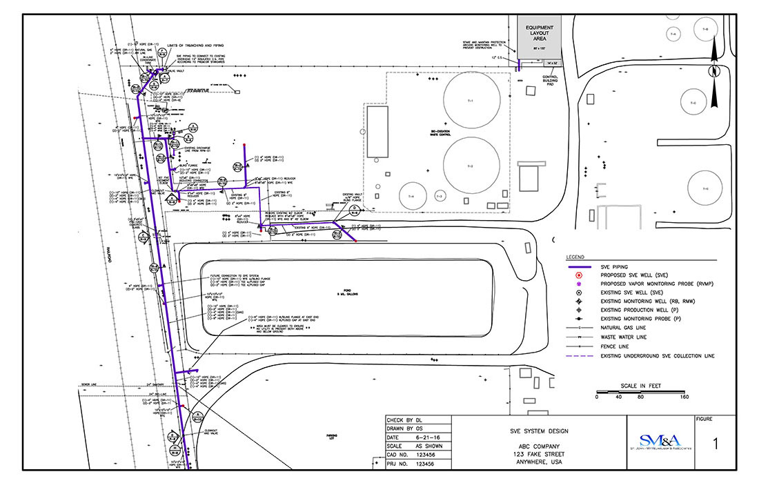
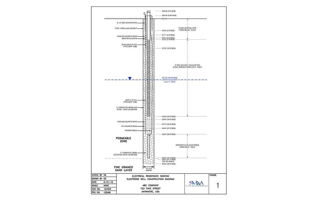
With an experienced staff of computer-aided design (CAD) professionals, SMA is equipped with the latest AutoCAD® Map 3D software, which allows us to create and convert data between widely used formats. Our experienced CAD operators can prepare a wide range of maps and engineering drawings suited to your drafting needs. SMA drafting services include:
Outsourcing your CAD drawings to SMA provides a flexible solution to your drafting needs. Our CAD professionals are experienced and have excellent drafting abilities, visual aptitude, and attention to detail. Please call us today to discuss how SMA can assist you on your projects.
• Interactive Graphing and Data Analysis
• Georeference Data Integration with Google Earth™
• Spider Diagrams and Drawings
• Historic Project Timelines